This postcard shows Chief Joseph Mountain as seen from Wallowa Lake. Chief Joseph Mountain is part of a large massif south of the town of Joseph. It makes up the northern extent of a ridge which includes Hurwal Divide to the south; the ridge then continues to Sacajawea Peak to the southeast and the Matterhorn further southeast. Access is available from the Hurricane Creek drainage to the west or the Wallowa Lake area to the east. Chief Joseph Mountain (AKA Point Joseph) is ranked as the 12th highest mountain in Oregon.
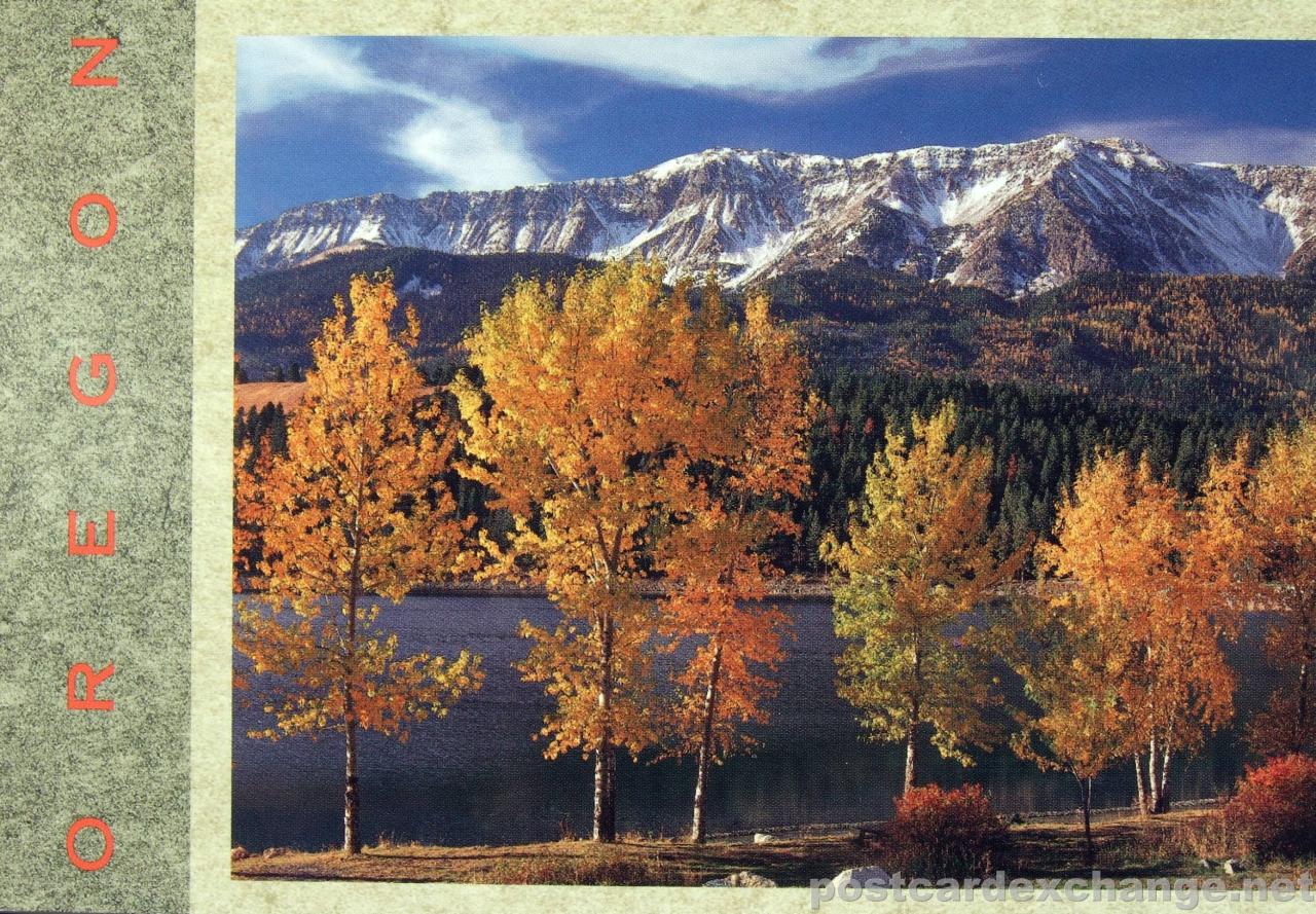
Wallowa Lake is a perfect morainal lake, which means it was formed by a glacier (about 9 million years ago). The lake is 5 miles long, and a mile wide, with a depth of 283′. Activities at the lake include: camping, backpacking, fishing, hiking, trail rides, hunting, boat rentals, swimming, water skiing, para sailing, horseback riding, pack trips, miniture golf, go karts and paddle boats.
Read more about Chief Joseph Mountain
Satellite image of Chief Joseph Mountain
Technorati tags: [ chief joseph | mountain | oregon | wallowa lake | postcard ]